Problem
- Since the 1990s, there has been a significant increase in the number of homes and businesses in the area, potentially affecting the natural flow of stormwater.
- Homes and roadways have been flooded during heavy rainfall events over the past 10 years.
- Current FEMA 100-year floodplain maps are more than 20 years old in much of the study area. There is no up-to-date technical information of the flood hazards in the area today.
Approach
- Apply state-of-the practice two dimensional computer modeling tools to update hydrology and hydraulics for the study area.
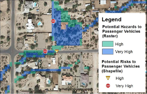
- Identify flood hazards and assess flood risk exposure to structures, roadways, and pedestrians.
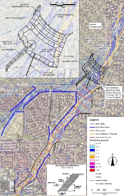
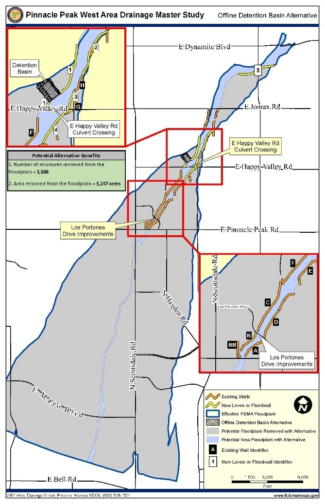
- Formulate conceptual alternatives to mitigate highest priority flood hazards.
Solution
- Reduce flood risk for current and future residents and property owners by evaluating the existing flood hazards and risks, conducting public outreach, and generating potential solutions to reduce flood risk.
- Minimize costs associated with flooding such as preventing the need for future public infrastructure and reducing potential flood damage costs for property owners.
- Improve the floodplain development and permitting processes by providing updated and easily accessible data on the existing flood hazards.
Location
Scottsdale, Phoenix, and Maricopa County, Arizona
Client
Flood Control District of Maricopa County
Project Leads
Rob Lyons
Ted Lehman
Mike Kellogg


