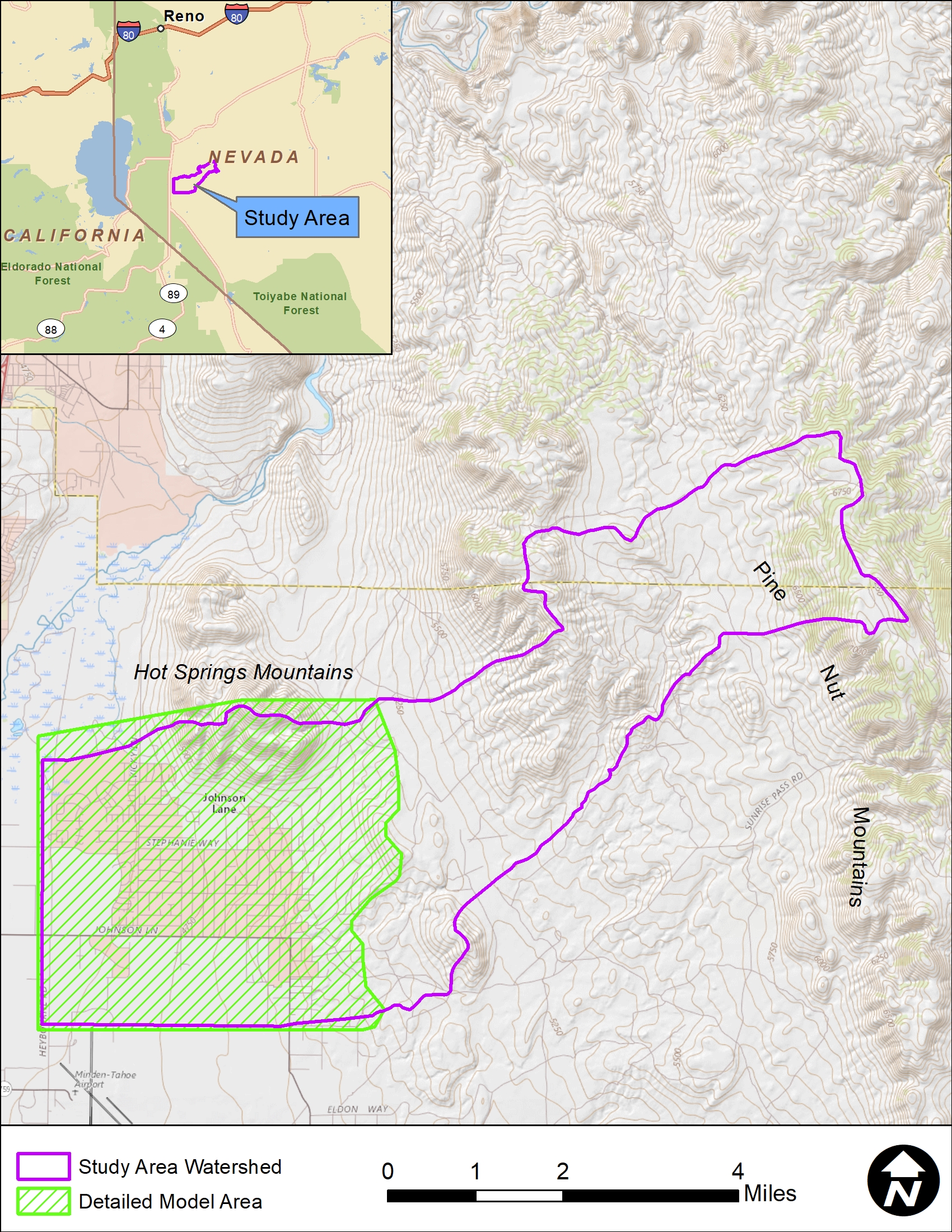
The Johnson Lane Area Drainage Master Plan (JLADMP) is encapsulated by three primary objectives: First – evaluate and identify flooding and sedimentation hazards within the Johnson Lane community by implementing a work plan that included data collection, review of previous studies, information gathering from public agencies and local residents, hydrologic and hydraulic modeling, geomorphic assessments, topographic mapping, and field surveys. Second – develop a series of alternatives to either partially or wholly mitigate the hazards identified in the first objective. Third – provide public outreach of the project through a series of public meetings to inform the public of the existing hazards and to present the mitigation alternatives. The study area is 27 square miles in size and is located on the eastern slopes above the Carson River Valley between Minden and Carson City.
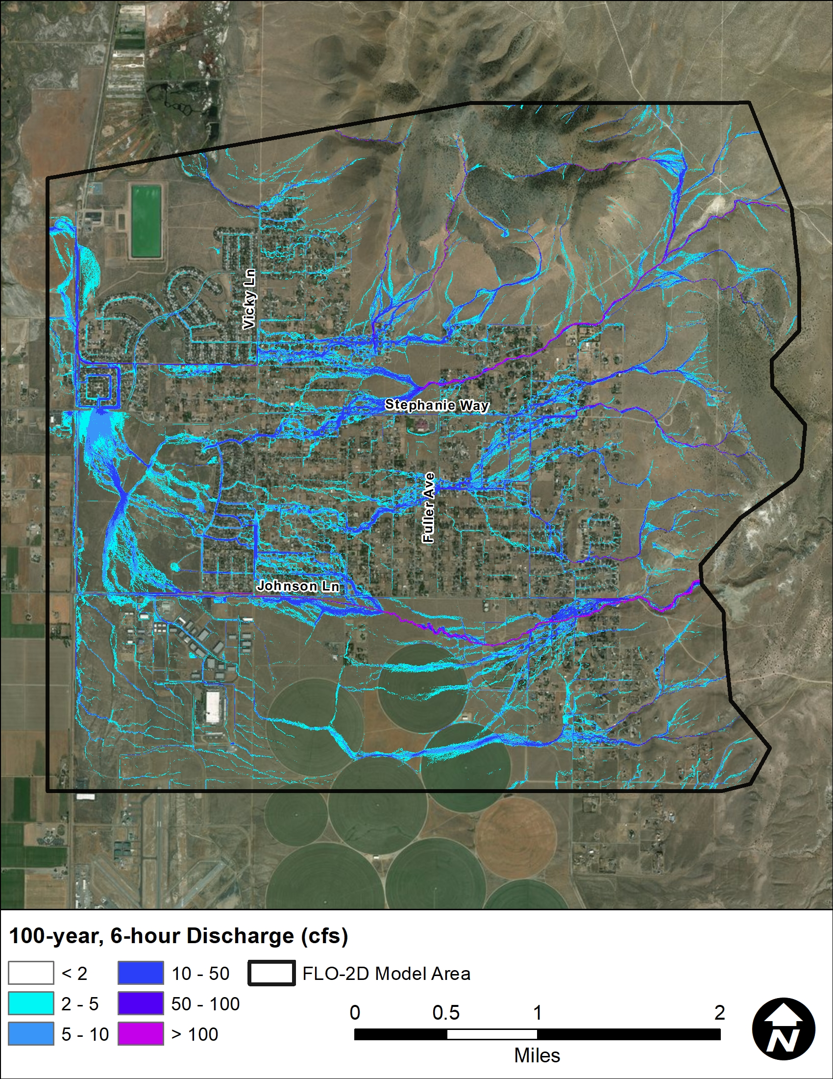
Four existing conditions FLO-2D models were created using the best available information for land cover, land use, topography, and hydrology. Every effort was made to ensure the models represented existing conditions as of the date of the project LiDAR survey. Photographs, videos, and anecdotal information collected from Douglas County and residents within the community were used to help calibrate and verify the modeling results. The modeling results reflect the complex flooding and sedimentation hazards that exist with the Johnson Lane community. The results provide valuable, quantitative, detailed information from which future planning and development decisions can be based.
A sediment engineering analysis was conducted and the results were used in two important ways:
- To quantitatively identify areas where sediment problems were most severe.
- To estimate the additional sediment volume necessary for flood control basin design.
Several flooding hazard methodologies conducted. These included:
- Flooding hazards to children
- Flooding hazards to vehicles
- Flood hazards to buildings
- Building inundation assessment
- HAZUS event-based analysis
These analyses help identify areas that have a higher risk of flooding and which property and infrastructure are most susceptible to damage. Having this information helps focus the mitigation alternative to areas where they are most needed. Additionally, the last two analyses (the building inundation assessment and the HAZUS analysis) help show if the proposed alternatives are reasonable and cost-effective. The HAZUS analysis is a FEMA approved methodology for computing potential economic losses and is a standard requirement for most grant applications.
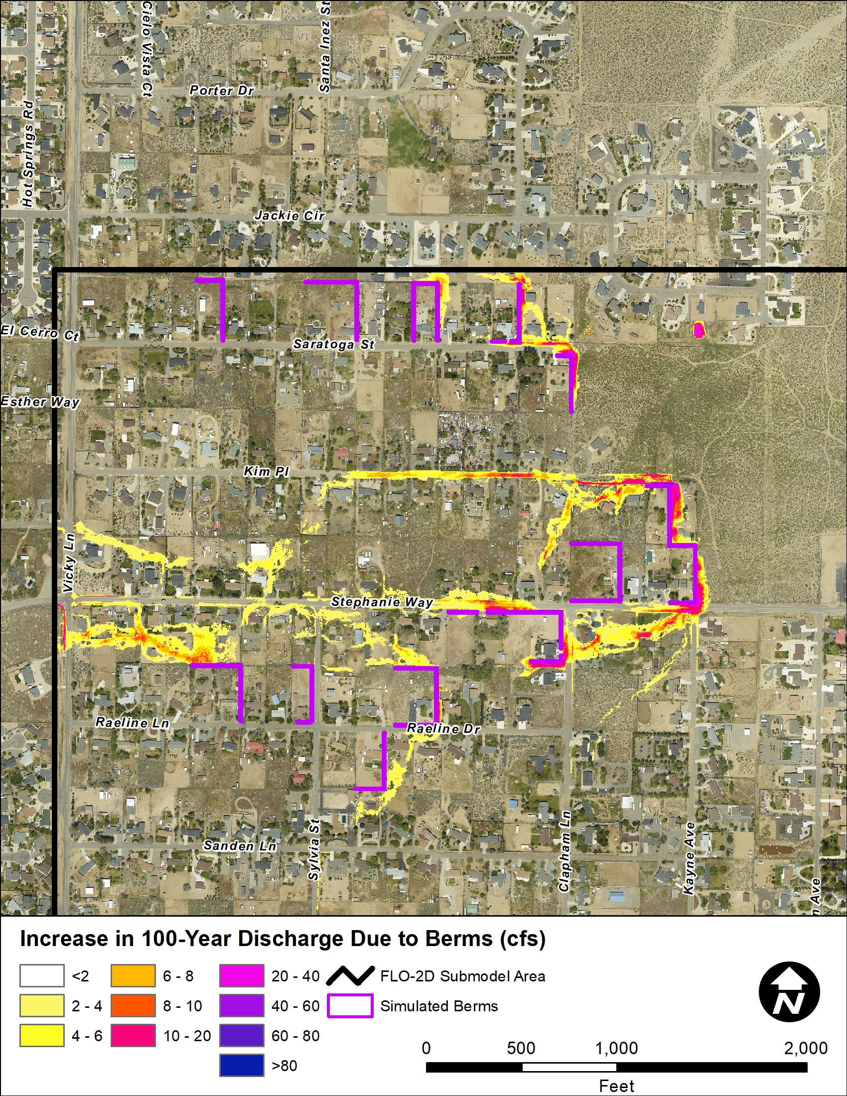
Douglas County requested an evaluation of the viability of several specific alternative concepts that have been suggested by Community Members, Douglas County Commissioner Board Members, and Douglas County Engineering Staff. Each of the following specific alternatives were assessed as part of the JLADMP:
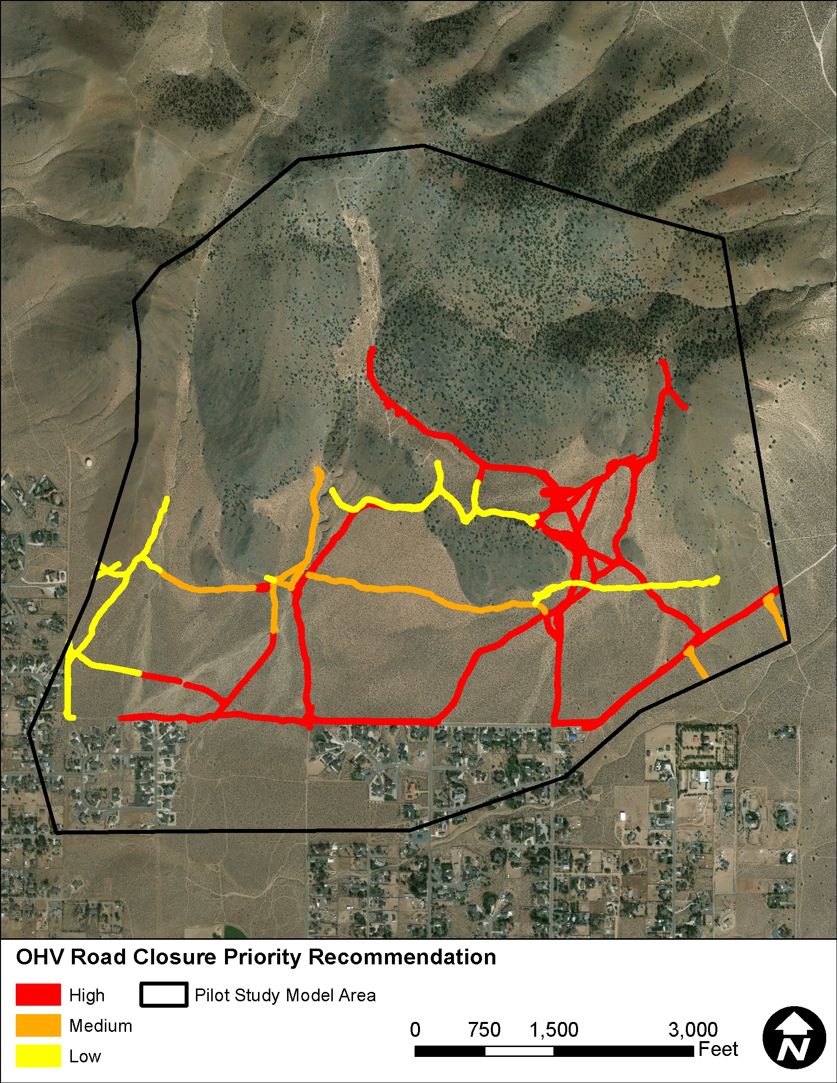
- Potential Off-Road Vehicle Use Impacts – Off-road vehicle use has resulted in the loss of natural vegetation and compaction of the soils within the public land areas. This alternative analysis evaluated whether the unpaved road network could result in adverse flooding and sedimentation conditions within the downstream community.
- Individual Lot Management – This concept explored whether flooding hazards within the community could be mitigated though implementation of an individual lot management plan rather than regional mitigation structures.
- Individual Lot Retention – This alternative analysis examined whether implementation of individual lot retention for storm runoff would be viable in mitigating the flooding hazards within the community.
- Driveway Culvert Sizing – This analysis was conducted to provide a community-wide template for recommended driveway culvert sizes.
- Roadside Ditch Lining – The roadside drainage conveyance ditches within the community are frequency burdened with sedimentation and require frequent maintenance by Douglas County via a mechanical scraper. This analysis explored which type of channel lining would be adequate to protect the bed and banks of the ditches from erosion while being compatible with the mechanical maintenance procedures.
- All-Weather Access – It is the desire of Douglas County to have all-weather, 100-year access for Johnson Lane, Stephanie Way, and East Valley Road. This alternatives analysis explored the viability of structural modification of only these roadways and right-of-way to permit all-weather access during 100-year frequency storm events.
- Regional Structural Alternatives for 25-Year and 100-Year Storms (Section 8) – This task evaluated a series of regional structures to mitigate both storm runoff and sediment for the 25-year and 100-year frequency storms. The structures evaluated included:
- Contour Trenches – This analysis explored the viability of using contour trenching in the upper watershed areas to reduce or eliminate the flooding and sedimentation hazards within the Johnson Lane community.
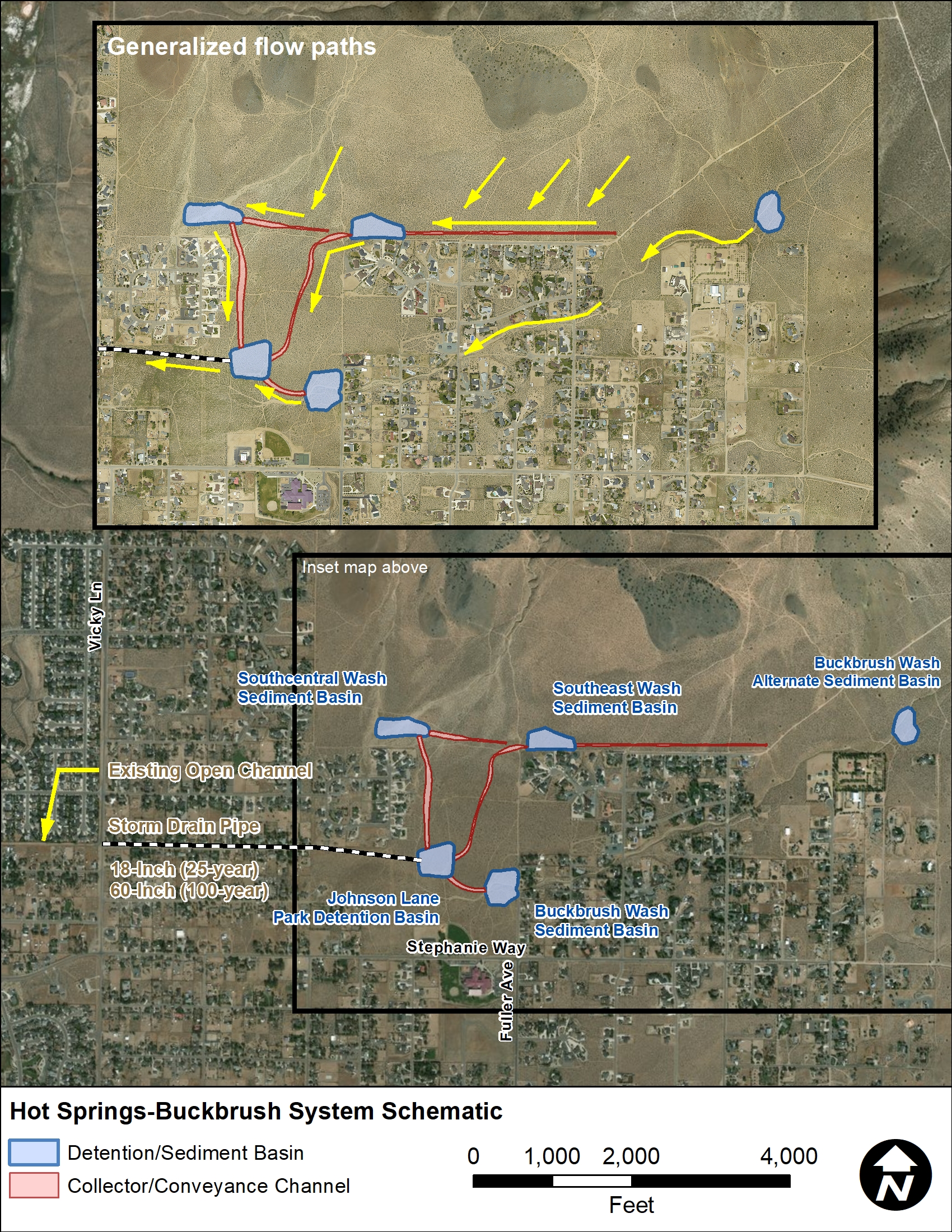
- Detention Basins/Channels – This analysis explored the potential reduction in flooding and sedimentation hazards through construction of a series of detention basins, interceptor channels, and conveyance channels.
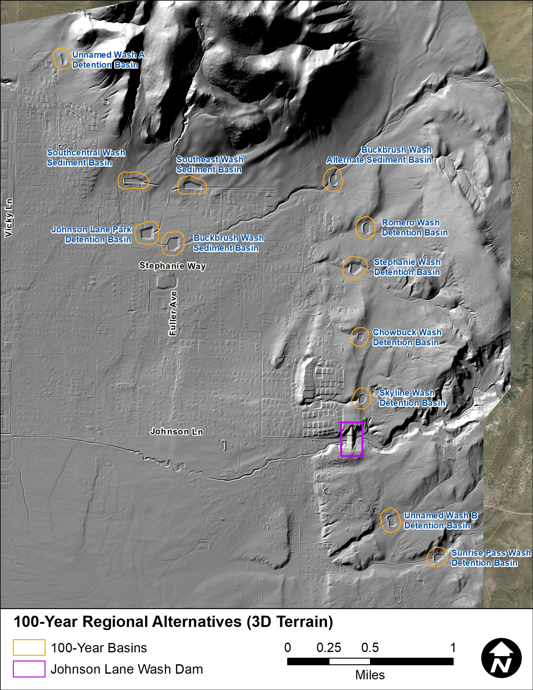
A total of 11 regional basins with a series of collector and conveyance channels were selected for this study. Although each individual basin functions to reduce the flooding and sediment hazards downstream, they are designed to work together as a system. Detention basin alternatives for Johnson Lane Wash were investigated both on BLM land and within undeveloped property downstream of East Valley Road. An upstream basin on BLM is not feasible because the Johnson Lane Wash floodplain is inset within a narrow geologic corridor with significant slope. A basin with sufficient storage capacity to mitigate the 100-year storm could not be sited within this corridor without raising the downstream basin embankment effectively creating a dam. A basin downstream of East Valley Road was also investigated, however it was also determined to be impracticable because 1) the immense basin size required to mitigate flooding downstream, and 2) it would not mitigate flooding hazards to the properties between East Valley Road and the MacKay Way alignment. The analysis resulted in the conclusion that a dam structure was the most feasible option for Johnson Lane Wash.
Location
Douglas County, Nevada
Client
Carson Water Subconservancy District and Douglas County
Project Leads
Mike Kellogg
Richard Waskowsky
Nate Vaughan
